Click image to return
to home page
Free Online Mapping Resources:
MapWindow and Other Programs
|
|
Free Online Mapping Resources: MapWindow and Other Programs
|
|
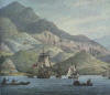
This is something of a work in progress on free resources available for quite high level mapping, available to all on the web. Some of this is not for the faint-hearted, but for those willing to persevere there are some incredible mapping resources out there... MapWindow MapWindow GIS allows vector based maps to be used in conjunction with a number of other programs like Google Earth and Google Maps to name a few. So what are the advantages of using MapWindow? The advantages of vector mapping mean that a map can be zoomed into infinitely without loss of picture quality (the program also works with jpegs and other image formats, so if these were added, picture loss would occur…). It’s interaction with Google Maps / Earth means that points from the one program can be easily transferred to the other. MapWindow also allows users to start with a blank canvas so to speak and layer up maps as best suits the user. Modern roads and features are particular inappropriate when designing an historical map and MapWindow is particularly useful when wishing to avoid these. Drawing and plotting your own shapes are also possible. Here is an example map: |
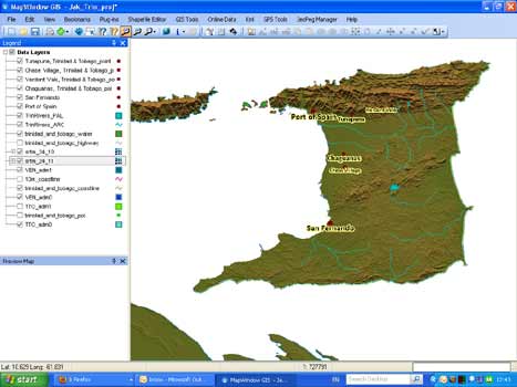
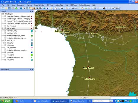
And zoomed in with some added highways/roads:
MapWindow is free and downloadable from here. The plug-ins are also very useful (like KML2Shapefile) and available here.
Using MapWindow
MapWindow is essentially a program which functions by displaying vector shapefiles. Here are some pointers to get you started
1. Once you have downloaded some of the plug-ins, you need to turn them on. Do this by selecting [Plug-ins] from the top menu, and selecting the particular plug-ins (GIS tools, shapefile editor not to mention KML2Shapefile are all very useful)
2. Try adding a new layer by going to the large plus sign. If you do not have any shapefile data, you will have to download some (see resources below like DIVA-GIS or geocomm.com etc)
For more information consult MapWindow’s documentation.
Other Useful Resources for MapWindow/GIS Software
CGIAR
The CGIAR Consortium for Spatial Information has downloadable digital elevation data for the whole of planet Earth. If you download a section of the globe, it produces great colour elevation maps, showing all the inclines and mountain ranges. For more, click here.
DIVA-GIS
For additional information and world data, some country specific data is available here (though much data is still lacking from this resource). For more, click here.
GeoCommunity
This is a good site with plenty of free georeference data downloads. Registration is necessary and free for the data however.
Getting internal data and rivers for maps outside the U.S.
While it is relatively easy to find plenty of resources disseminating perfectly free data on U.S. internal features such as rivers, it is much harder to find these particularly small places on the globe outside of North America and Europe. Trinidad, Cuba, St. Lucia, Haiti, the Dominican Republic therefore may require a little extra perseverance to retrieve internal data.
One way to get data on internal rivers, such as those on Caribbean islands, which are much smaller than illustrious or large rivers like the Amazon, is to download data from geocomm.com. Be warned, this is not for the faint hearted. Follow these steps to get small country rivers (or indeed small rivers for countries):
1. Register with geocomm.com (this is free)
2. Visit the country index site.
3. Locate country by clicking on the alphabetical letter with which the country begins or use the search bar to enter the country name
4. Click on ‘hydrography'
5. Click on the normal download (light blue) next to the particular data (this should be free to download as opposed to the premium)
6. Download the data to a memorable folder (such as one with all MapWindow place data in it)
7. Now the file is in E00 format and will require further conversion. See below
Converting an E00 file to a shapefile, readable in MapWindow
1. Download Import 71 either via ESRI (registration required but free) here. Alternatively you can also download it from geocomm.
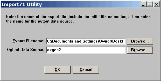
2. In the top box, enter E00 file you wish to export. In the ‘Output Data Source’ box below, enter the name you wish to cover the generated ArcInfo files, so St_Lucia_rivers etc
3. Now download FWtools package for Windows, available here and ArcINFO2Shape GUI, available here (unzipping the latter)
4. Unzip the program into the ‘bin’ subdirectory of the FWTools directory, and either run it from there or make a shortcut to it on your Start Menu or Desktop. You should see:
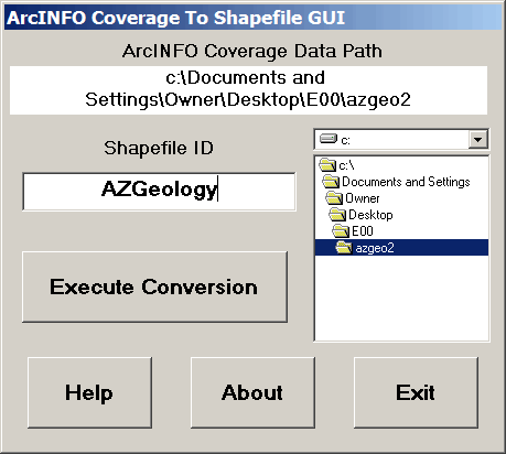
5. Select the drive and directory of the ArcInfo files created with import71. Enter a shapefile ID name into the lower box. Click ‘execute conversion’ and the shapefiles will be generated
6. In MapWindow, the files should now be ready to be added to any layer
This is a condensed version of information available from this website.
To plot points from Google Earth to MapWindow
1. Download the add-on KML2Shapefile while MapWindow is not running
2. Open MapWindow
3. Make a folder, perhaps in your MapWindow directory, for all your places/plots of interest
4. Open Google Earth
5. Find point on Google Earth, by searching for city, street, place etc in the toolbar. Right click on the searched for place and select ‘Save Place As’
6. Save the file as a KMZ file in your designated places/plots folder
7. Open MapWindow and on the menu above, go to KML, and click ‘import as shapefile’. This should then add the point as a layer on the map (in shapefile format)
Other Websites of Interest
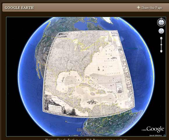
David Rumsey's historical map website is particularly interesting for the sheer volume of historical maps. It is particularly good for U.S. maps, but has a number covering the wider tropical American region, with Codazzi's maps of Gran Colombia, and a few eighteenth-century maps of Cuba, St Lucia, St Vincent etc. Click here to visit Rumsey's site.
Rumsey's maps are also interactive with Google Earth:

![]()